CCTV News: According to the website of the Central Meteorological Observatory, meteorological monitoring shows that yesterday, affected by cold air, gusts of 6 to 8 occurred in central Inner Mongolia, Beijing-Tianjin-Hebei, western and southern Liaoning, and local levels of 9 to 11. This morning, 6 to 10℃ cooling occurred in central and southern North China, central and northern Huanghuai, eastern Liaoning, eastern Jilin, eastern Tibet, southeastern Qinghai, and northern western Sichuan Plateau, with a local drop of more than 12℃.
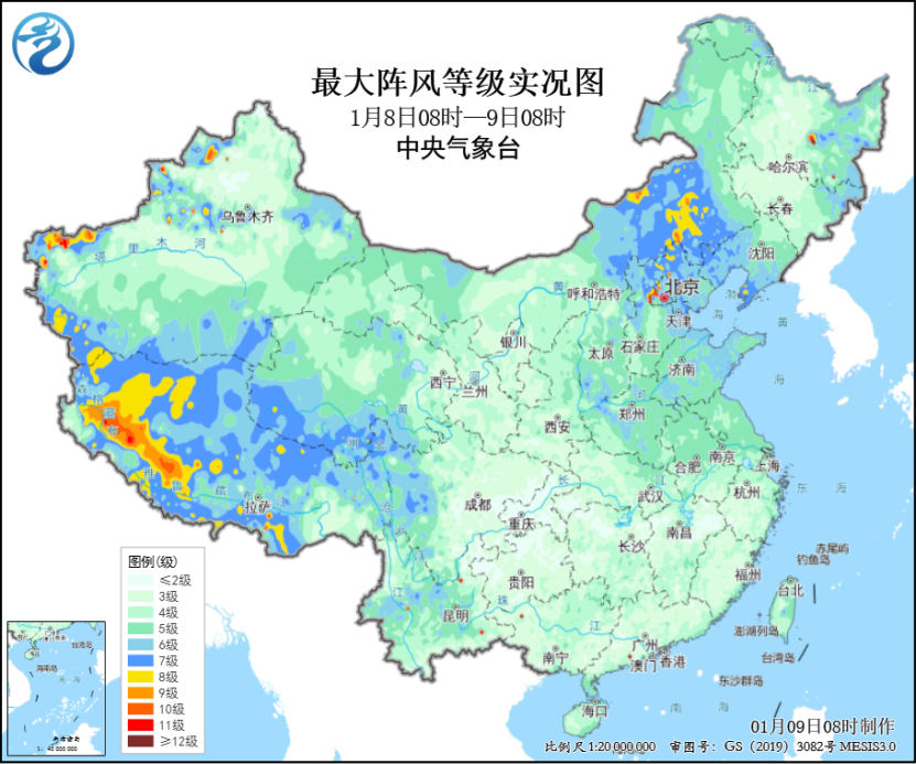
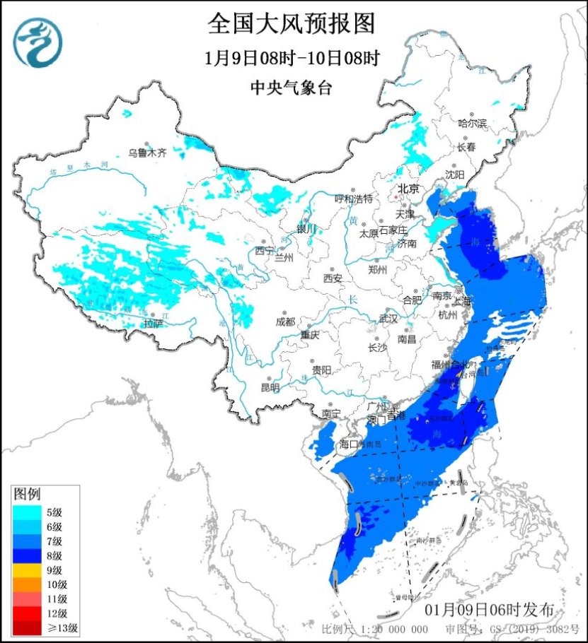
Today, the impact of cold air continues. It is expected that Jianghan, Jiangnan, eastern Guizhou, western South China and other places will experience 4 to 6℃ cooling, with local cooling of more than 8℃; Bohai Sea, Bohai Strait, most of the Yellow Sea, most of the East China Sea, Taiwan Strait, the ocean east of Taiwan, the Bashi Strait, Beibu Gulf, and most of the South China Sea will have strong winds of level 7 to 8 and gusts of level 9. Among them, some areas of the Taiwan Strait can reach level 9 and gusts of level 10, and the blue warning for strong winds is taking effect.
Subsequent cold air will follow. From the 10th to the 12th, there will be 4~6℃ cooling in northeastern Xinjiang, central and western Inner Mongolia, eastern Northwest, and Qinghai-Tibet Plateau and other places, with local drops of more than 8℃, accompanied by winds of 5~7 and gusts of about 8%. From the 14th to the 16th, cold air will also affect central and eastern my country, bringing large-scale strong winds and cooling weather.
In terms of rain and snow, in the next three days, the weather will be sunny in most parts of the country, and there will be weak rain and snow in the western region. Among them, there will be light snow or sleet in some areas such as the western Sichuan Plateau, northeastern Yunnan, central Guizhou, western Hunan, eastern Xinjiang and western Gansu. There will be light rain in the Sichuan Basin, southern Guizhou, eastern Yunnan, and southern Hunan.
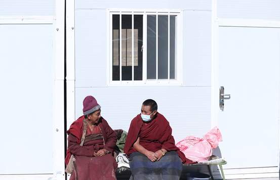
Dingri County, Tibet and its surrounding areas will still be sunny in the next three days. The minimum temperature at night can reach -15℃, and there will be strong winds of 7 to 8 levels from afternoon to evening. Rescue personnel and people in the disaster area need to keep warm and warm. Pay attention to the safety of fire and electricity when using heating equipment. Temporary resettlement sites should do a good job in wind protection and reinforcement of tents and other facilities.