CCTV News: According to China Weather Network, the north has been so warm these two days! This afternoon, the temperature in the North China Plain was generally above 10℃. For example, the temperature in Beijing was 15:00 pm, which set a new high this year for two consecutive days. In the sunny and warm sunshine, I felt a little hot when I walked a few steps quickly.
This big recovery that swept most of the central and eastern regions will continue. The north will usher in this warm peak tomorrow, and the south will usher in a high temperature the day after tomorrow.
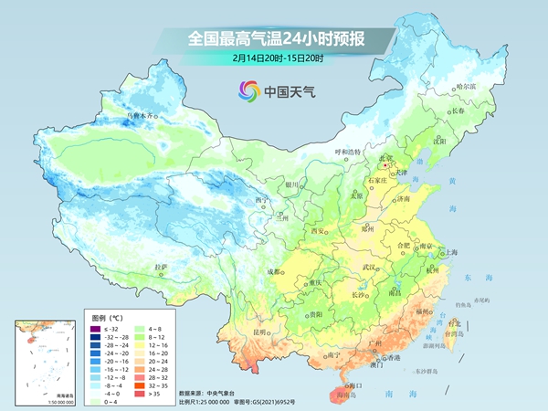
From the maximum temperature of the process, the maximum temperature 10℃ line will push the north to the northern part of Hebei-central Shanxi-north Shaanxi area. The temperature in the North China Plain and many surrounding areas will set a new high this year; Henan, eastern and western Shandong and most areas in the south will reach or exceed 15℃, among which Hubei, southern Jiangnan and southern China can reach about 20℃. The temperatures in the above areas will be significantly higher than the same period last year.
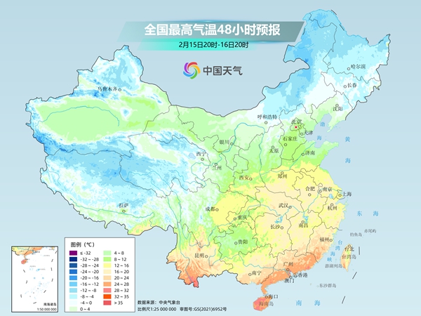
For example, the highest temperature in Shijiazhuang tomorrow will rise to 16℃, which is the warmest day this year, 8℃ higher than the average level in mid-February; the highest temperature in Wuhan on the 16th may impact 20℃, which is more than 8℃ higher than the same period of the year, and both north and south are warmer than before.
Friends who are familiar with the "routines" of the weather may also guess that after the Great Nuan, they will often be the "correction" of cold air.
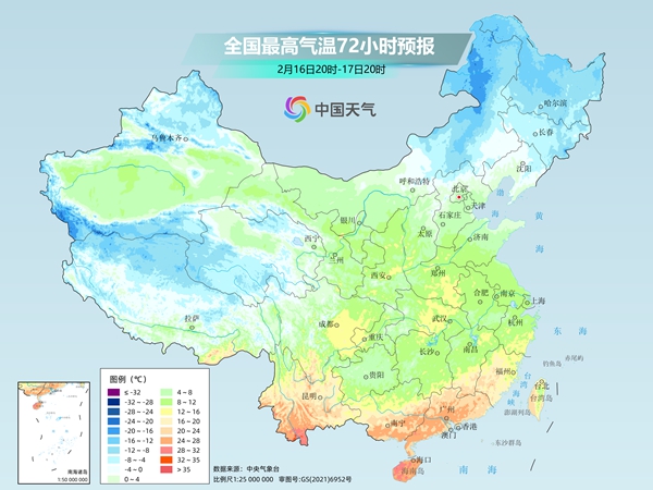
Starting tomorrow, a new round of cold air will affect the central and eastern regions. After the 17th, cold air will continue to penetrate south. Since the warmth has been too warm in the past few days and the base temperature has been raised, the cumulative cooling rate will be relatively large, although the intensity of the cold air is not strong.
From the process, Inner Mongolia will take the lead in cooling tomorrow, and the cooling range will be expanded to Northeast China, North China, and Huanghuai on the 16th, and will then go south all the way to affect most southern regions. The cumulative cooling range of the highest temperature in most areas such as Northeast China, central and eastern North China, Huanghuai, Jianghuai, Jianghan, Jiangnan and other regions can reach 6~10℃, and some areas exceed 10℃. After the temperature drops, the temperature will drop to normal or low levels. The feeling of cold winter is about to return!
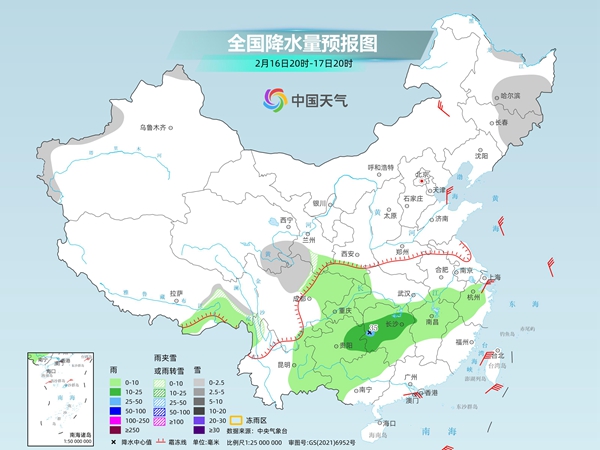
With the "blending" of cold air and the "coordination" of warm and humid air flow, the south will have frequent precipitation in the next week, and there will be three rounds of precipitation: today to tomorrow, from the 17th to the 18th, and from the 19th to the 21st, the precipitation will not be heavy, mainly light to moderate rain.
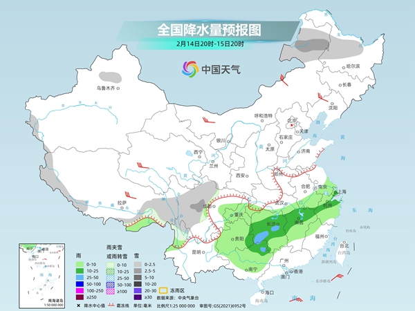
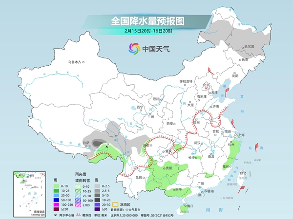
A new round of precipitation has begun today. The rainfall in the south will weaken tomorrow from day to the 16th. Many places in Jiangxi, Zhejiang, Fujian and Guangdong will clear up on the 16th. From the 17th, the precipitation will develop eastward again and will continue until the end of the middle.
Since February, Sichuan, Chongqing, Guizhou and other places have the most frequent rainfall, and the cumulative precipitation has been significantly higher than the same period of the previous year. In some areas, 1 to 2 times the same period of the previous year. In the next 7 days, the above areas will still be frequent. Pay attention to preventing continuous rainfall from geological disasters such as landslides, collapses, etc. in mountainous areas.