Tibet is one of the main distribution sites of marine glaciers in my country. In order to find out the "family" of these glaciers, the China Geological Survey of the Ministry of Natural Resources will officially launch my country's first marine glacier aerial exploration in Changdu, Tibet today to grasp the development laws and ablation changes of marine glaciers and provide basic data support for natural resource management.
CCTV reporter Yang Xiao has been following the investigation team for glacier detection.
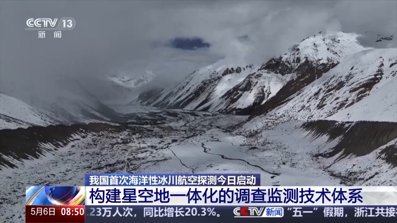
The first detection point was selected at Renlongba Glacier
CCTV reporter Yang Xiao: My current location is Ranwu Town, Basu County, Changdu, Tibet. In a while, I will set out with the investigation team to the Renlongba Glacier 30 kilometers away here, which will be the first survey point for this marine glacier aviation exploration.
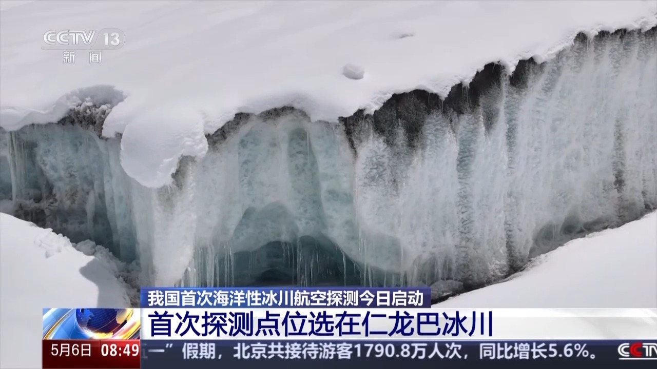
Renlongba Glacier, as a famous marine glacier in Tibet, is one of the rare modern mountain glaciers in the middle and low latitudes on the earth. Not only is it still in its original state, but this glacier is easy to approach, unlike most other glaciers that can only be seen from a distance. This glacier allows us to climb onto the ice tongue.
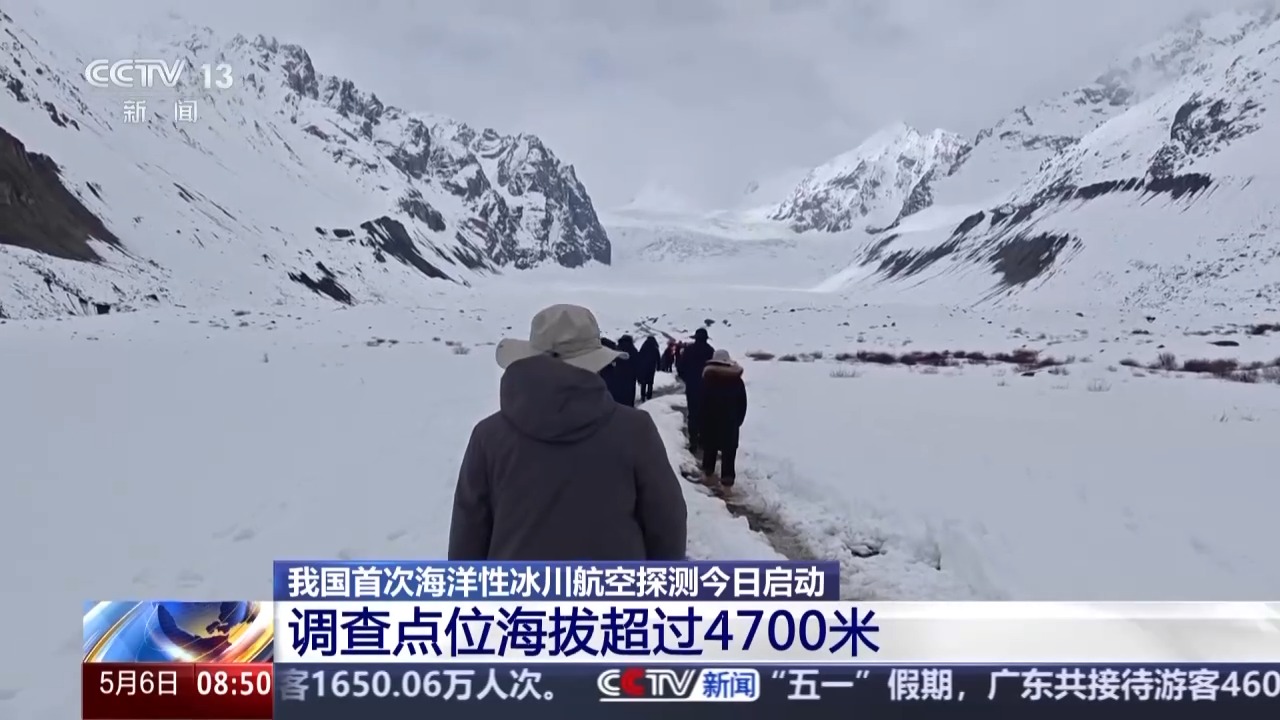
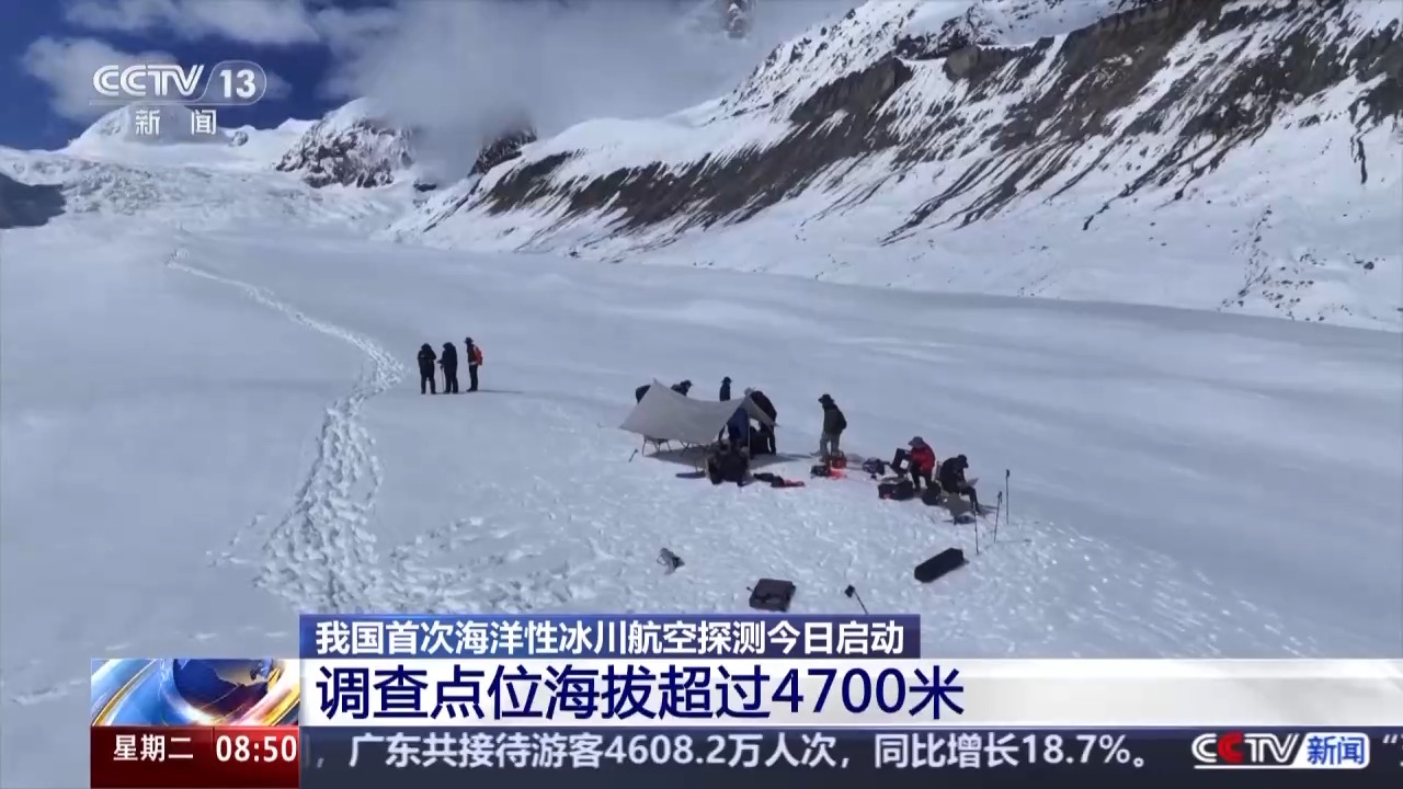
The altitude of the survey site exceeds 4,700 meters
The distance from Ranwuzhen to Glacier is only more than 30 kilometers. Why set off so early?
Because we all have to take a car for nearly an hour to reach the entrance of the glacier, and then hike 2.5 kilometers to reach the foot of the glacier. This is not the end. From now on, we have to climb for nearly 40 minutes and climb to the live broadcast point with an altitude of 4,745 meters on the glacier to see the working conditions of the investigative team members at an altitude of more than 4,700 meters.
Constructing an integrated survey and monitoring technology system for starry sky and ground
Speaking of this investigation, this time, in view of the characteristics of high altitude, low temperature and large area of the glacier area, an integrated survey and monitoring technology system for starry sky and ground is built, which uses satellite remote sensing, helicopter aerial geophysical exploration, and comprehensive ground investigation to obtain information on the scope and thickness of the glacier, so as to grasp the status of my country's glacier resources.
Investigators will work at the Renlongba Glacier for several days starting today
Investigators told us that with the launch of today's investigation, they will work at the Renlongba Glacier for several days. Today is mainly ground operations, and tomorrow, the helicopter will take off at an appropriate time according to the weather conditions.
(CCTV reporters Yang Xiao, Zhong Min, Chen Qin, Wu Tianbai, Jin Xiaoxi)