CCTV News: From April 11 to 12, a strong wind, sandstorm and cooling weather will occur in central and eastern my country. The Central Meteorological Observatory issued a warning for yellow winds and blue sandstorms on the 10th, and the China Meteorological Administration launched a level 3 emergency response. What are the causes and effects of this round of cold air?
When strong winds come, how to prevent adverse effects?
How to prevent adverse effects in response to the upcoming strong winds? How to interpret different warning signals?
Beijing, Tianjin and Hebei Province issued orange warning signals for strong winds
Beijing and Hebei Province meteorological departments issued orange warning signals for strong winds on April 10, and Tianjin meteorological departments successively issued orange warning signals for strong land and strong sea winds.
According to the "Measures for the Issuance and Dissemination of Meteorological Disaster Warning Signals", the warning signals of strong winds (except typhoons) are divided into four levels, from low to high, represented by blue, yellow, orange and red respectively.
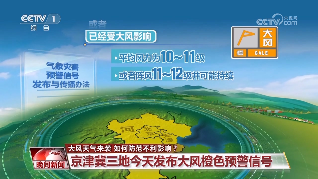
The orange warning signal for strong winds means that the average wind may be affected by strong winds within 6 hours, with the average wind speed above level 10, or the gusts above level 11, or the gusts may be continued.
According to current meteorological analysis, 6:00 to 22:00 on the 12th will be the strongest period of wind in Beijing. Even in the plain urban area, gusts may reach level 10 or above.
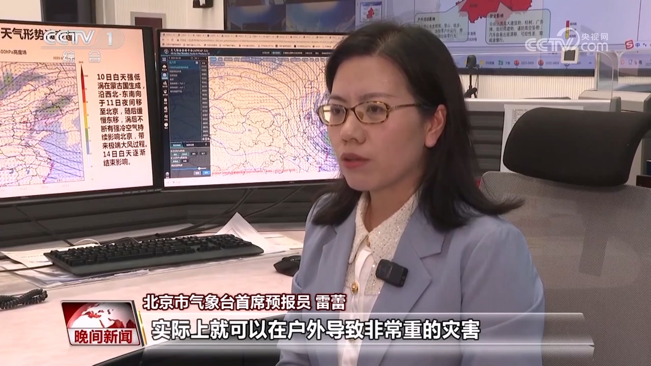
Chief Forecaster of Beijing Meteorological Observatory Lei Lei: Level 10 gusts can actually cause very serious disasters outdoors, such as big trees or telephone poles falling down. The Beijing plain area has gusts of 9 to 11 levels, and the duration is relatively long and the impact range is relatively wide.
Beijing: Wind prevention emergency reinforcement equipment to check for safety hazards
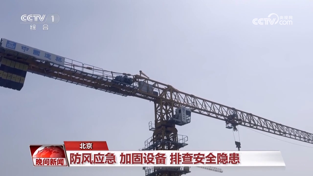
Faced with the upcoming continuous strong winds, how can the city ensure safety and stability? All public service departments and enterprises in Beijing will make arrangements and deployments as soon as possible, especially inspecting tower cranes, construction elevators and other facilities and equipment one by one to ensure safety and stability.
Central Station reporter Gao Xue: After receiving the strong wind warning, many construction sites under construction in Beijing have responded to emergency responses. The worker is using steel nails to reinforce the exposed land on site to reduce dustproof nets.
Beijing urban management department carries out safety inspections for outdoor advertising and plaque signs. The railway and civil aviation departments will adjust their operating plans according to the wind magnitude and remind passengers to pay attention to traffic information at all times.
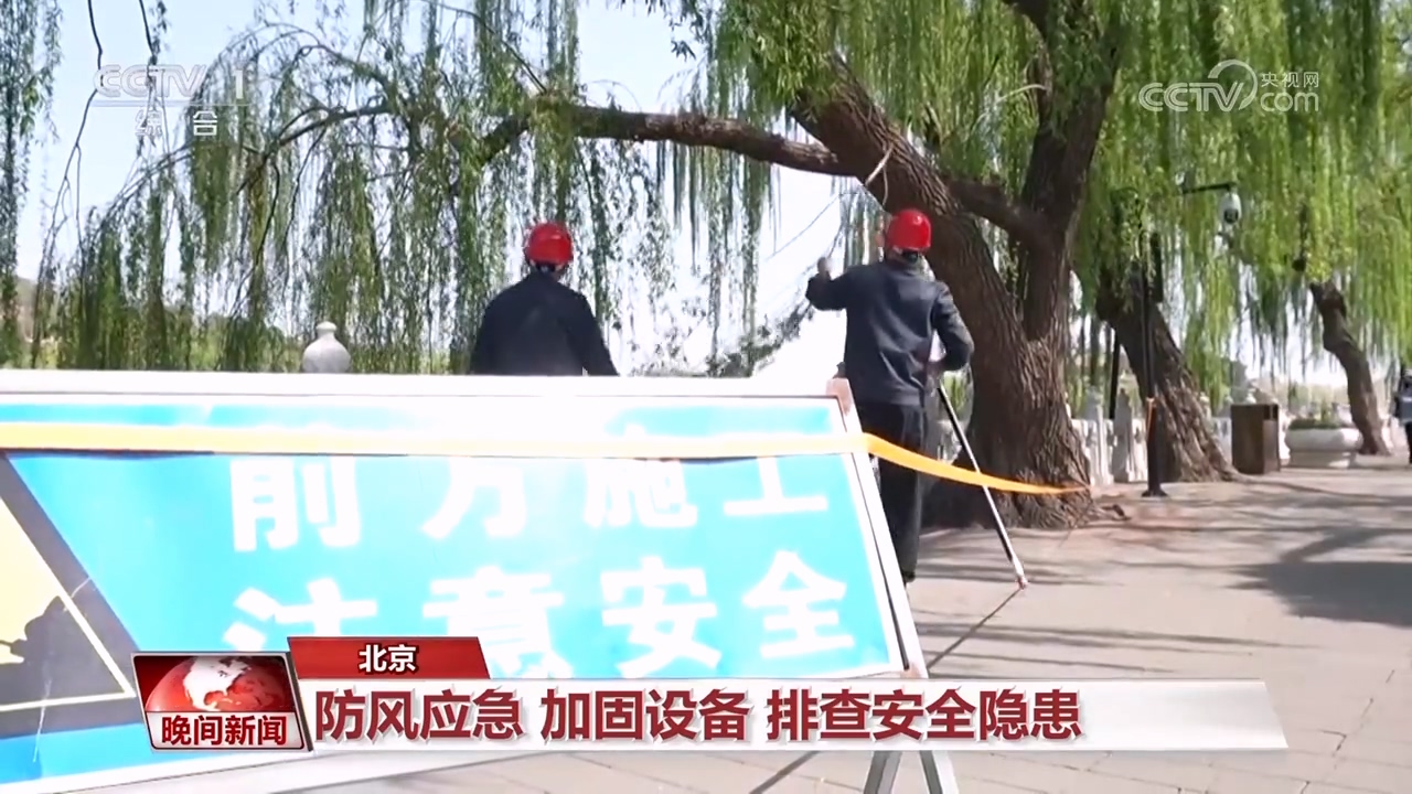
The staff of Beihai Park urgently prune willow trees that are prone to lodging. Beijing World Park, Xishan National Forest Park and other scenic spots and parks have issued announcements that temporary closure measures will be taken on the 11th and 12th. Visitors who have purchased tickets can choose to refund tickets on the online platform.
What should be paid attention to during the strong winds?
The first thing to do is to stop organized outdoor sports or gatherings, and primary and secondary schools, kindergartens, and relevant training institutions should stop outdoor activities.
The public avoids open-air activities and strictly prohibits all outdoor fire use.
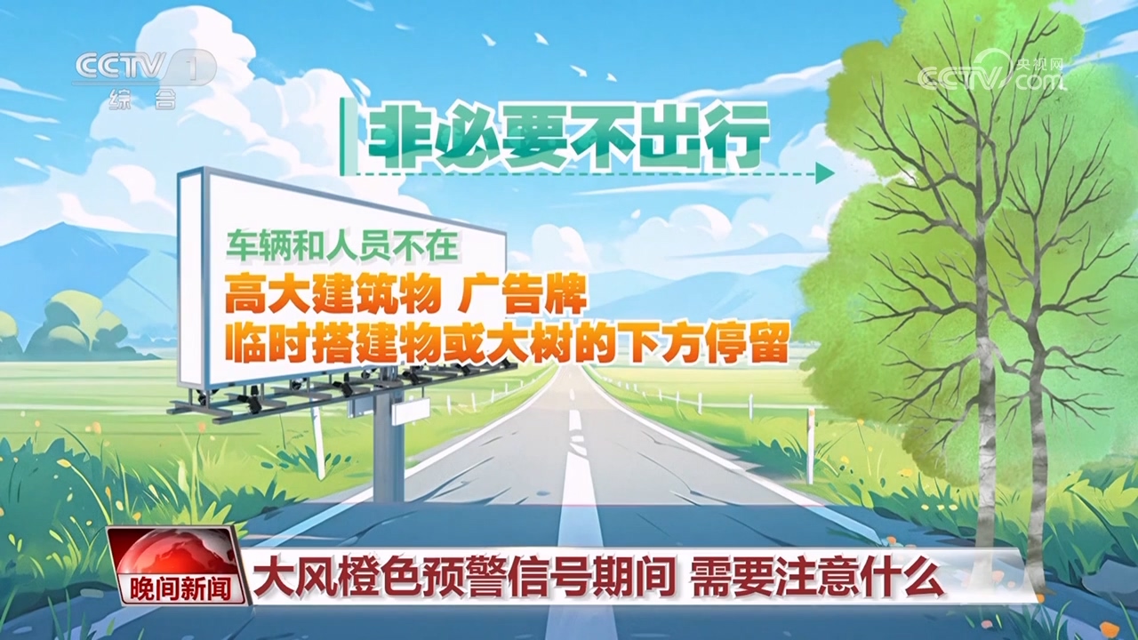
Don't travel unless necessary, vehicles and personnel do not stay under tall buildings, billboards, temporary buildings or big trees.
Stop all outdoor construction and entertainment activities.
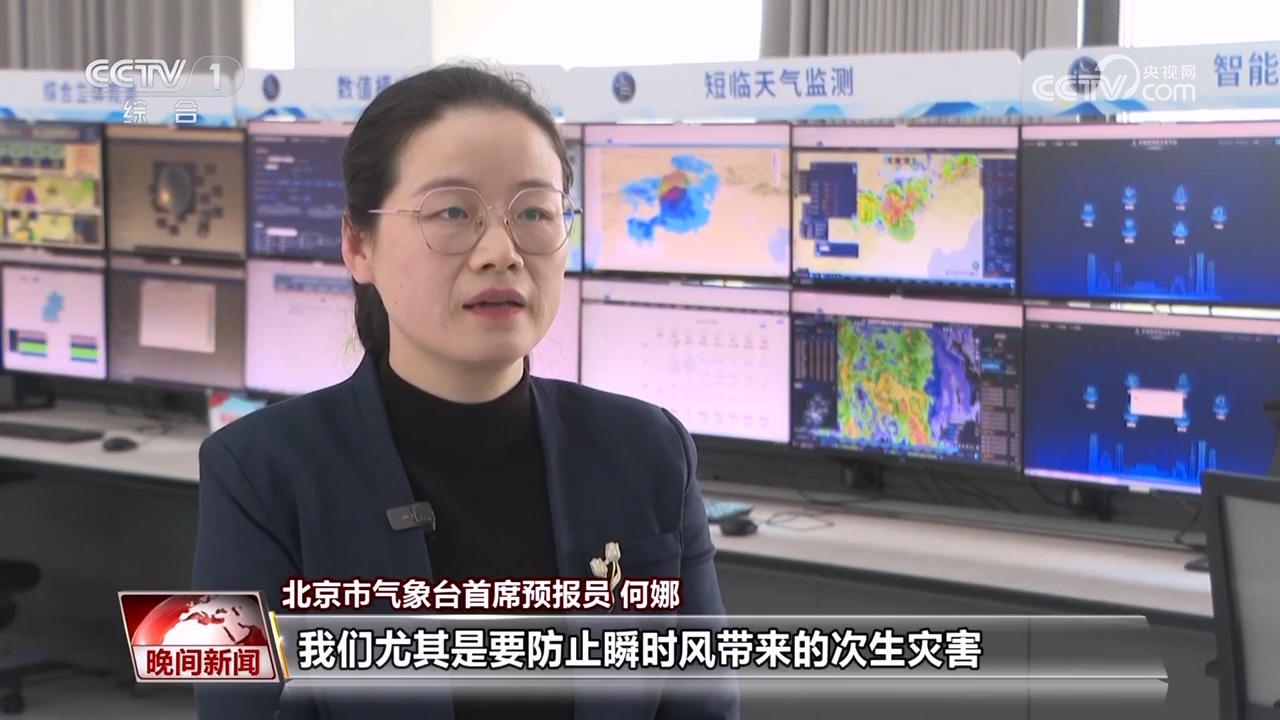
Chief Forecaster of Beijing Meteorological Observatory He Na: We must especially prevent secondary disasters caused by instantaneous winds. If the instantaneous wind is strong, the catastrophicity will be relatively strong. Try to avoid going out at the stage where the wind is strongest.
Prevent the influence of instantaneous wind and avoid the "narrow tube effect"
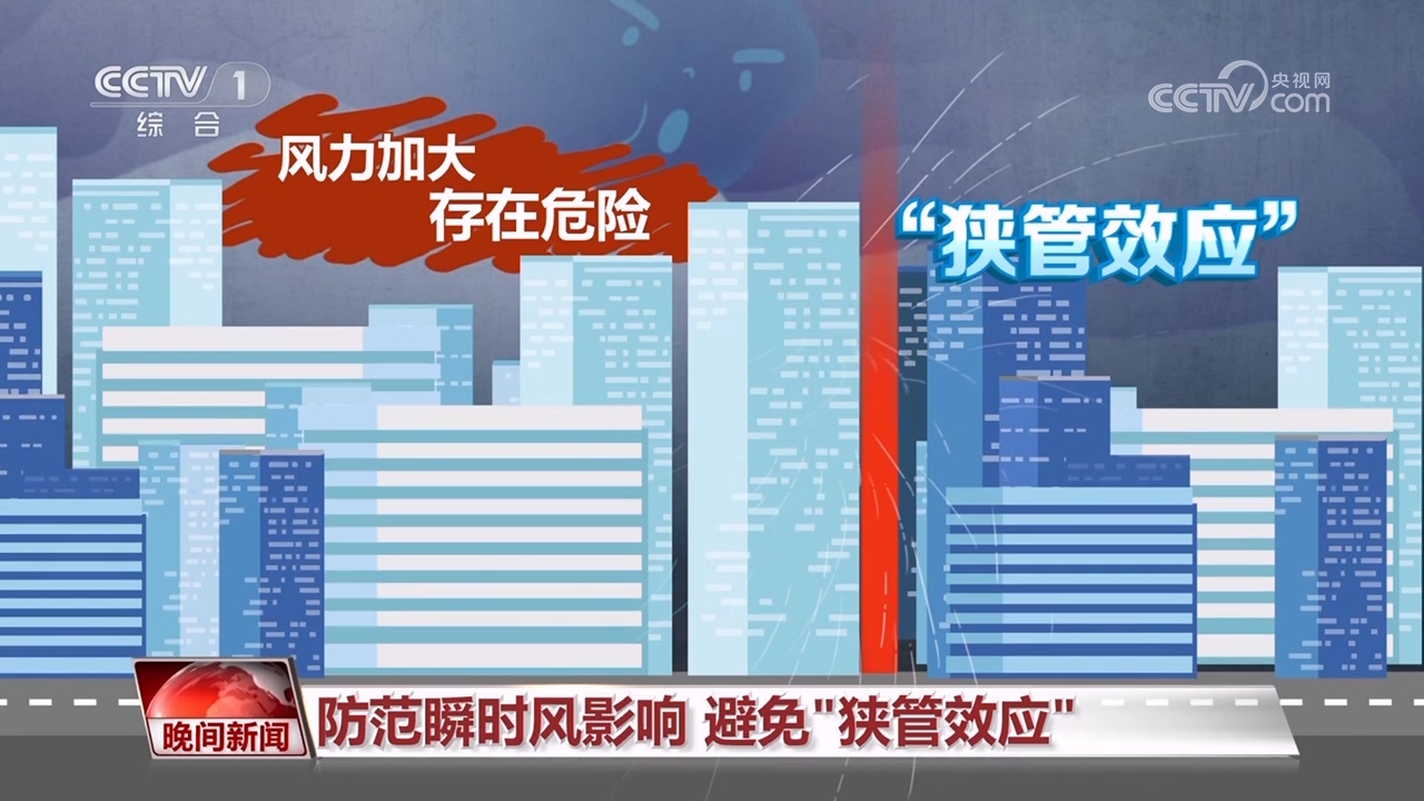
The meteorological department reminds that in strong winds, remember to close the doors and windows and put the fragments on the outdoors and balcony into the house. Try to avoid narrow passages between tall buildings when walking or cycling outside, because narrow passages will form a "narrow tube effect", and the wind will increase in the passage, which poses certain dangers.
Specially remind couriers and takeaway workers who are staying at their posts to ride slowly and avoid the through-the-room style formed by urban buildings. We also hope that citizens who order takeaway should not urge them.